The Paper Map Problem
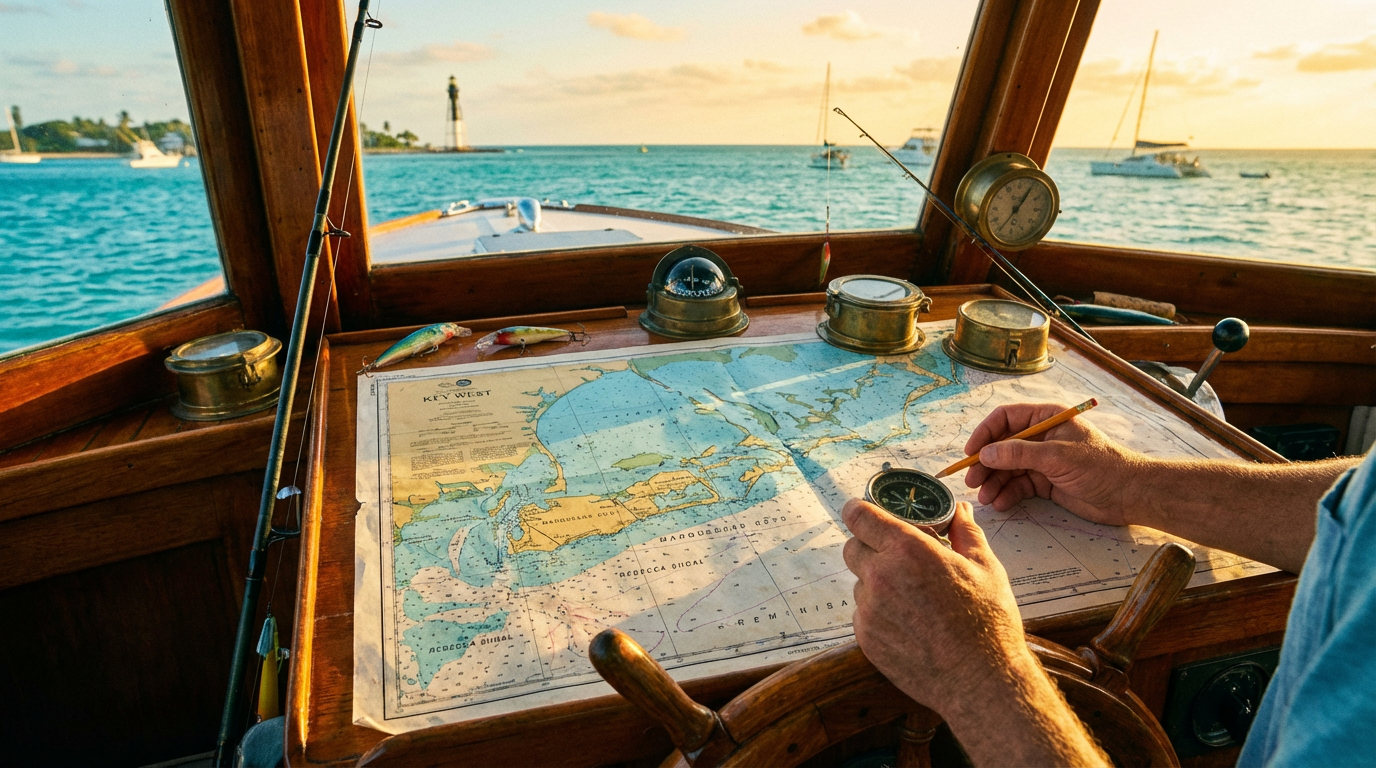
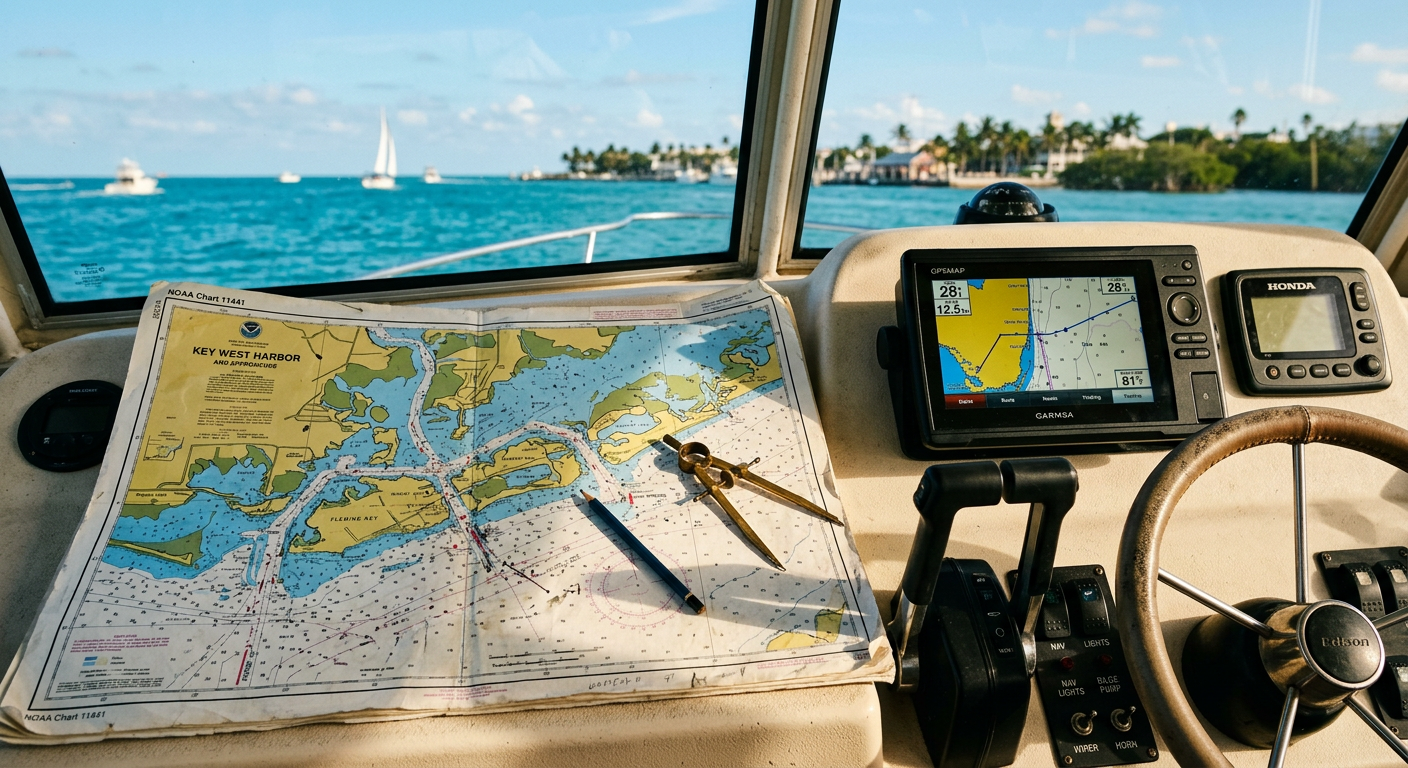
The stiff plastic of a laminated Key West fishing chart feels rough under my thumb where drying salt spray has crusted over the outdated contour lines. The skiff drops into another wave trough near Sand Key. A fresh sheet of water washes across the non-slip deck. A standard map comes in two flavors around the marina. It is either a glossy calendar telling you what bites when, or a depth layout pointing out wrecks. Both lie.
According to the National Oceanic and Atmospheric Administration, migration patterns mapped out back in 2018 do not match the water conditions of 2026. Mahi-mahi show up later in the season now. The tarpon shifted their transit lanes a few miles closer to the reef. Research is my love language; reality is my ex. You can memorize the printed feeding schedules sold at the tourist traps on Duval Street all afternoon. The marine ecosystem operates on a different clock.
The water looks dull green today. We are anchored about two miles from the coastline. The marine radio chatters in bursts of static. Ahead of the steering column, a faded yellow bumper sticker warns about manatees from a decade ago. The captain's left rubber dive boot is missing a shoelace.
I can't prove this, but I swear the mutton snapper shift their territories every time a new map gets published. The ocean floor rearranged itself after a late winter storm pushed sand banks across the Marquesas Keys. You hand over twenty bucks at the marina expecting a guarantee. What you get from a printed reference is a historical snapshot of where the grouper used to live. For current intel, local captains rely on daily networking and live sonar data to find a depth of exactly 48.2 feet over a new rubble pile. Yes, 48.2. I spent twenty minutes calibrating the transducer dial purely out of spite to prove the laminated grid wrong.
If you want to catch dinner without eavesdropping on a scrambled commercial radio channel, booking a trip through Rockon Recreation Rentals—an official VisitFlorida Travel Partner—puts you on a boat with someone who understands the current bite. Leave the static guide on the dashboard of your rental car.
3 Reasons Why a Printed Key West Fishing Chart Misleads Anglers
The scent of diesel exhaust mixed with cut ballyhoo is the heavy perfume of a solid offshore strategy down here. Glossy brochures love to present seasonal availability in neat color blocks. They make it look like sailfish automatically arrive on November first by punching a time card. A baseline Key West fishing chart gives you historical averages. The fish respond to current water temperatures and bait movement.
Wind Directions Change Everything
The winter slump models show a dead zone for big game species when December hits. The narrative shifts when the wind blows out of the north for a few consecutive days. Catch data monitored by the Florida Fish and Wildlife Conservation Commission shows that northern gusts push the Gulf Stream closer to the reef, dragging sailfish right to the edge of the drop-off. The marina empties out, leaving the best ocean stretches open for those who read the prevailing winds instead of a laminated grid. If it's on a postcard, it's a trap.
Our captain spins the wheel toward the Atlantic side. The hull slaps against small waves, spraying a fine mist over the bow. The air hangs at about eighty degrees.
Chasing the Moving Bite
For years, I looked at the dog days of late August as a cursed time to book a trip. I assumed the hot shoreline water drove everything deep into the trenches. I realized the offshore bite does not vanish. It just relocates to the floating Sargassum weed lines further out. The static maps show empty blue space fifty miles off the coast. In reality, those drifting golden vegetation mats harbor dozens of hungry dorado eager to chase surface lures.
Seeing a flash of neon yellow streak through clear water provides a physical jolt. Booking through Rockon Recreation Rentals connects you with guides willing to burn the extra fuel to find those transient floating structures.
You need a guide who treats a standard Key West fishing chart as a baseline suggestion rather than a rigid mandate. Skip the glossy seasonal tabs. Trust a seasoned captain's morning intuition.
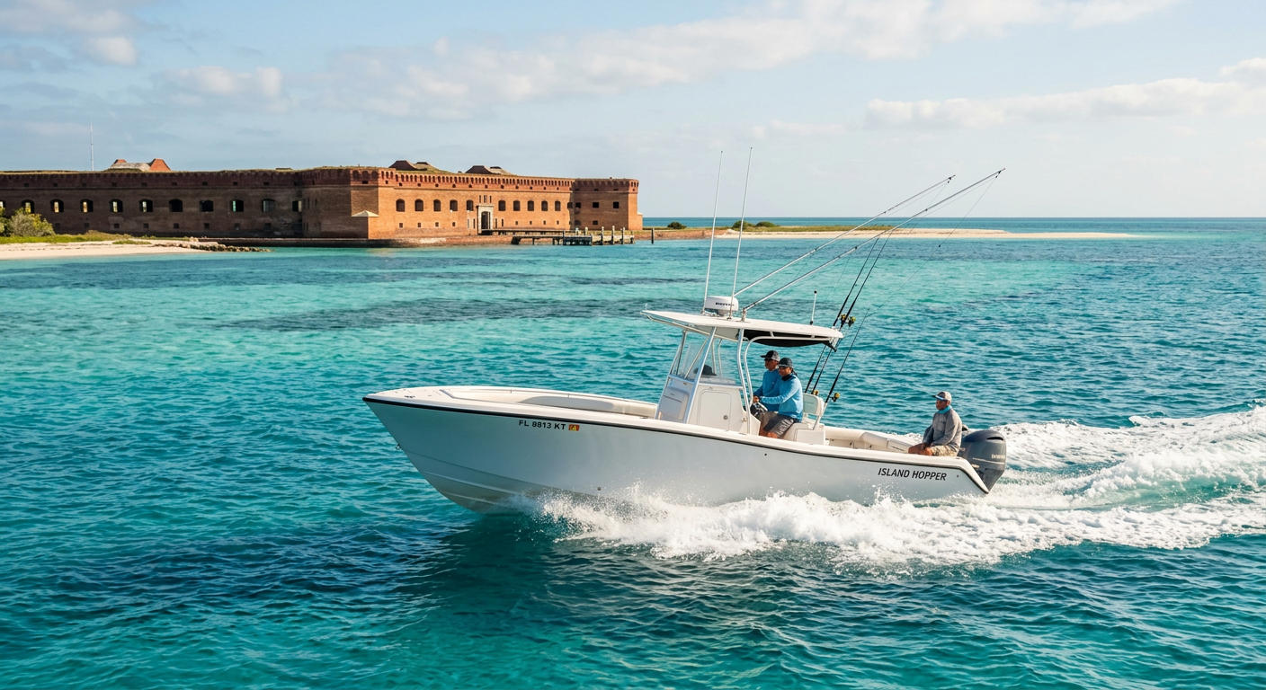
Why The Dry Tortugas Glitch Ruins Official Boundary Lines
A bitter swallow of old marina coffee coats my throat as the brick walls of Fort Jefferson crest the horizon. Heading out here feels different than hugging the immediate coastline near the main island. Beige travel blogs will tell you it is a smooth ocean voyage across paradise. Reality involves gripping a heavy fiberglass cooler while bouncing over three-foot chop for two straight hours. But seeing the deep offshore blue transition into a glowing turquoise shelf makes the bruised tailbone worth the struggle. Beige is a sin.
The Dry Tortugas region sits about seventy miles west of Key West. You take a powerboat or a seaplane to reach the islands. There are no tackle shops or permanent restaurants waiting at the dock. It is just brick, water, and birds.
Here is the problem with relying on a primary Key West fishing chart past the Marquesas. The printed depth lines suggest a predictable reef slope, but this ecosystem operates under its own jurisdiction. A laminated map stops being useful the moment you cross the national park boundary where the current rips through the coral channels. The "glitch" is that the protected, no-fishing preservation zones drawn on paper rarely align with where the baitfish actually hold. To stay legal and still find a bite, you need someone who runs these remote waters for a living. The energy is off out here if you don't know the invisible lines.
I usually hate offshore boat runs because they eat into the casting schedule. I expected to resent the long transit time today. Then a massive school of yellowtail snapper swarmed the surface before we even cast a line near Rebecca Shoal. I can't prove this, but the fish out here seem to know when your guard is down. You spend an hour and a half bracing against the waves, only to get a strike seconds after you relax your shoulders.
4 Reasons Why a Physical Plan Survives the Digital Age
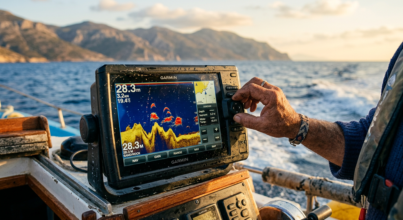
A low mechanical hum rising from the center console reveals what happens to boat electronics around midday. Modern dashboard setups look like glass spaceships equipped with glowing display panels. That high-tech illusion breaks about forty miles past the Marquesas Keys under the blazing afternoon sun. Glare turns expensive navigational screens into dark mirrors. To operate a marine touchscreen, your fingertips need to be dry. We sweated. The screen blurred.
We get defensive about our smart devices. 2019 me would have laughed at bringing a paper map on a modern skiff. 2026 me knows that lithium batteries die quickly when fighting for a satellite signal through heavy cloud cover. A digital backup loses its appeal when it leans on the same fragile power network as your primary console.
The Glare and the Grid
According to safety protocols from the U.S. Coast Guard, keeping physical navigation tools on board serves a practical reason. Mobile tablets overheat and trigger thermal shutdowns right when you need to navigate around a shallow coral head. I figured analog navigation was just stubborn nostalgia for captains who refused to adapt.
Then my primary display froze during a brief afternoon squall near Boca Grande Key, blinding us to the surrounding depths. My guide just chuckled, reached into his dry box, and unrolled a battered paper layout across the helm. Seeing him verify our drift over the shallow shoals without waiting for a screen to buffer changed my mind. A waterproof Key West fishing chart holds its value because it never overheats.
The Tactile Advantage
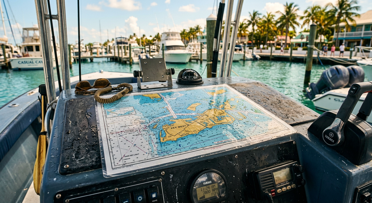
Tracing a route across printed topographical lines provides an intuitive sense of scale a pinched screen cannot duplicate. The heavy waterproof paper holds a satisfying grit after years of sun exposure. Its surface is dotted with faint coffee rings and faded pencil coordinates marking successful tuna runs from previous seasons. When a stray wave splashes over the helm and floods the viewing table, you just brush the water onto the deck. The layout stays readable.
Reserving a charter through Rockon Recreation Rentals puts you on deck with an experienced local who understands these dual systems. Quality captains always stash a weathered map below the steering column. They let the sonar scan the bottom, but trust the paper to double-check reality when the electronics glitch.
When the Straits of Florida Rewrite Your Itinerary
Thick midday heat pastes my cotton shirt to my spine when the wind dies around noon. We drift over the jagged blue line marked on a fresh Key West fishing chart. The ink promises a steep underwater ledge holding hungry pelagics. We wait.
A half-empty bottle of sunscreen rolls into the scupper grate and stops. The bait drifts without a strike.
A glance at the running sonar explains the empty hooks. The physical ledge sits where the map claims, but the Gulf Loop current reversed itself overnight. That shift pushed the water column sideways against the reef block, flipping the feeding setup. Trust your gut on this, even if the brochure says you are dropping lines in the perfect strike zone. If the current is backward, the fish are facing the wrong way. The predators are not holding on the ocean side of the drop-off like the 2026 seasonal guides predict. They shoved up onto the shallow shelf to ambush bait trapped by the reverse flow. The paper is just a drawing of rock. The ocean dictates the terms.
According to daily vessel reports, working captains pull live buoy data from the National Data Buoy Center and trust their own eyes over a laminated grid.
Surviving the Reef Reality
Visitors grip their diagrams like safety blankets. Locals watch the water color change. The Straits of Florida punish anybody expecting nature to follow printed directions. You have to adjust to the physical conditions.
- Watch the floating Sargassum weed lines. Those habitats get pushed miles inland when the prevailing winds shift direction.
- Monitor the physical temperature breaks. Offshore species follow shifting thermoclines rather than the bottom contours marked on a reliable map.
- Respect the tide schedules above all published coordinates. A famous mutton snapper spot holds zero fish during a dead slack tide.
The chart indicates we are leaving the main striking zone. A dozen quick hookups over the next hour prove the map wrong.
3 Ways to Leave the Beige Tourist Trail Behind
The sudden smack of the Yamaha outboard shifting into neutral breaks the quiet. The coarse non-slip fiberglass scrapes lightly against my bare heels as the skiff drifts off-plane. Water slaps the hull in uneven bursts.

The tourist industry thrives on selling certainty. Go where the paper is crumpled and the coffee is terrible. A battered notebook covered in fish blood out-fishes a commercial Key West fishing chart every time.
I used to follow those seasonal tables like maps to gold. I figured the printed grid held some metric I misunderstood. The reality is far less romantic. The fish care about water temperature and current edges, not the month printed on a rack brochure. You learn to watch the water and ignore the schedule.
When you ride with local experts, they ignore the calendars and chase the baitfish instead. You haul the muddy anchor as the afternoon heat breaks. The ride back to Stock Island is a blur of gray swells, diesel exhaust, and the steady thud of the hull crushing chop.
You tie off the worn dock lines. The paper map stays on the dashboard.
Plan your trip: Ready to experience this firsthand? Book Dry Tortugas Fishing Charters and Island Adventure directly through our marketplace.