The Problem With Staged Nature Photos
A thick wave of vanilla body spray cuts through the idling SUV exhaust before you even take a step. It feels like a standard Appalachian morning right until the wind shifts. You stand thirty yards from the trailhead for one of the most popular waterfall hikes asheville nc has to offer. The paved lot holds exactly 83 vehicles. It hit capacity about an hour ago. People pace around the asphalt, waiting for a spot.
The woods finally swallow the engine noise once you step past the information kiosk.
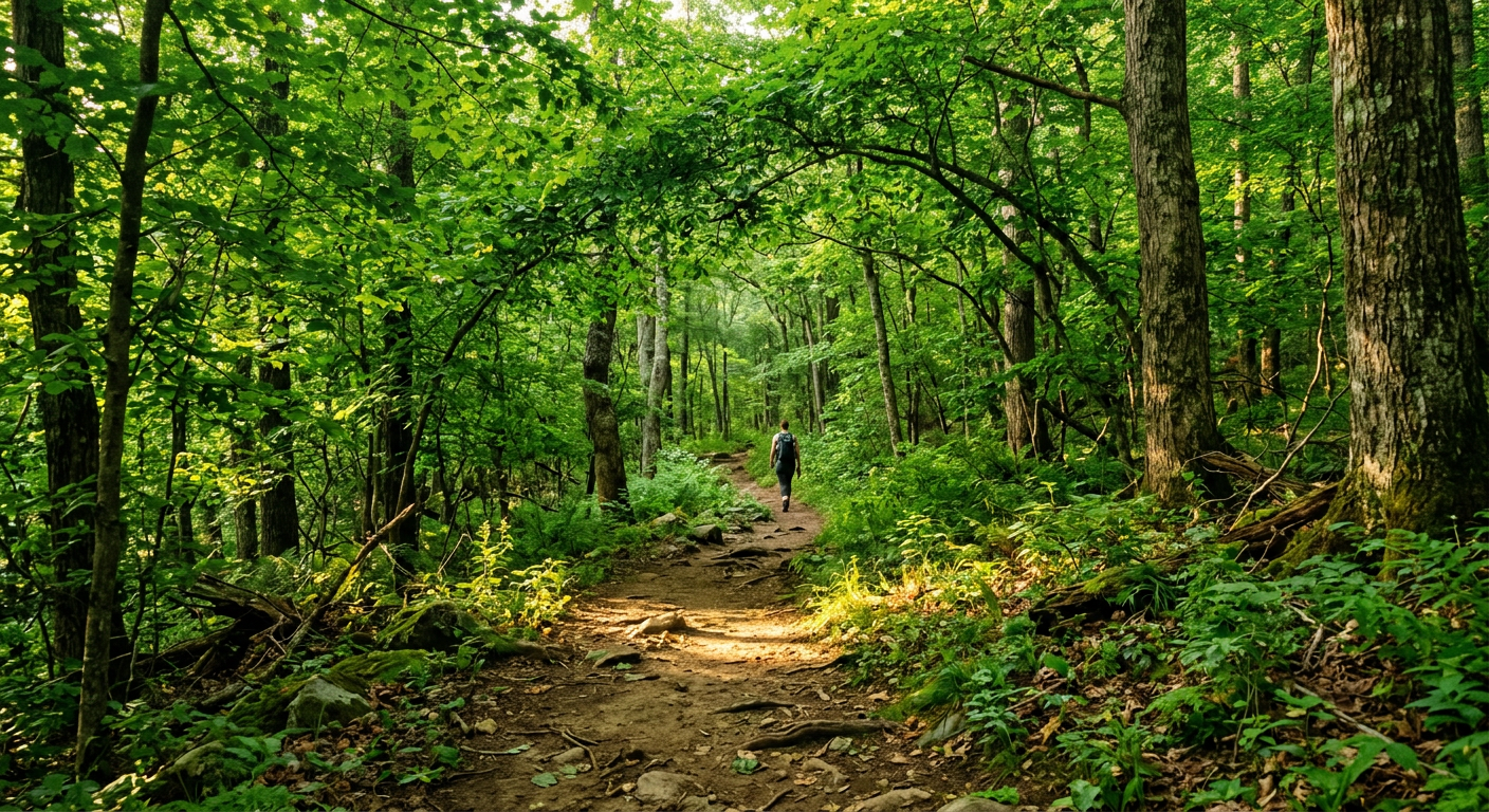
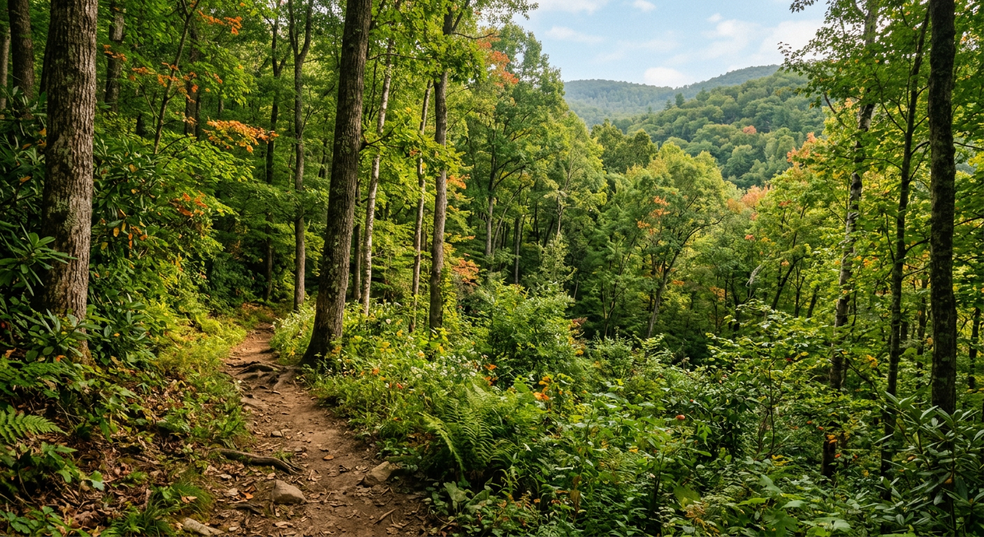
The heavy humidity of the dense forest presses against your chest. A nearby stream hums, cold water slicing over slick gneiss rock. It sends up a fine mist that settles against the back of your neck. You look up to frame a mental photograph of the canopy. You trip over an exposed cedar root.
According to the US Forest Service, this specific approach gains roughly 400 feet of elevation in the first half-mile. That statistic remains abstract until you feel the sharp burn in your calves. Many visitors expect a flat walk to a painted backdrop. If it is on a postcard, it is a trap. The mountains make you climb.
The Reality Behind the Frame
The wide path chokes down into a single muddy rut near the first switchback. The loudest people always get quiet on the uphill.
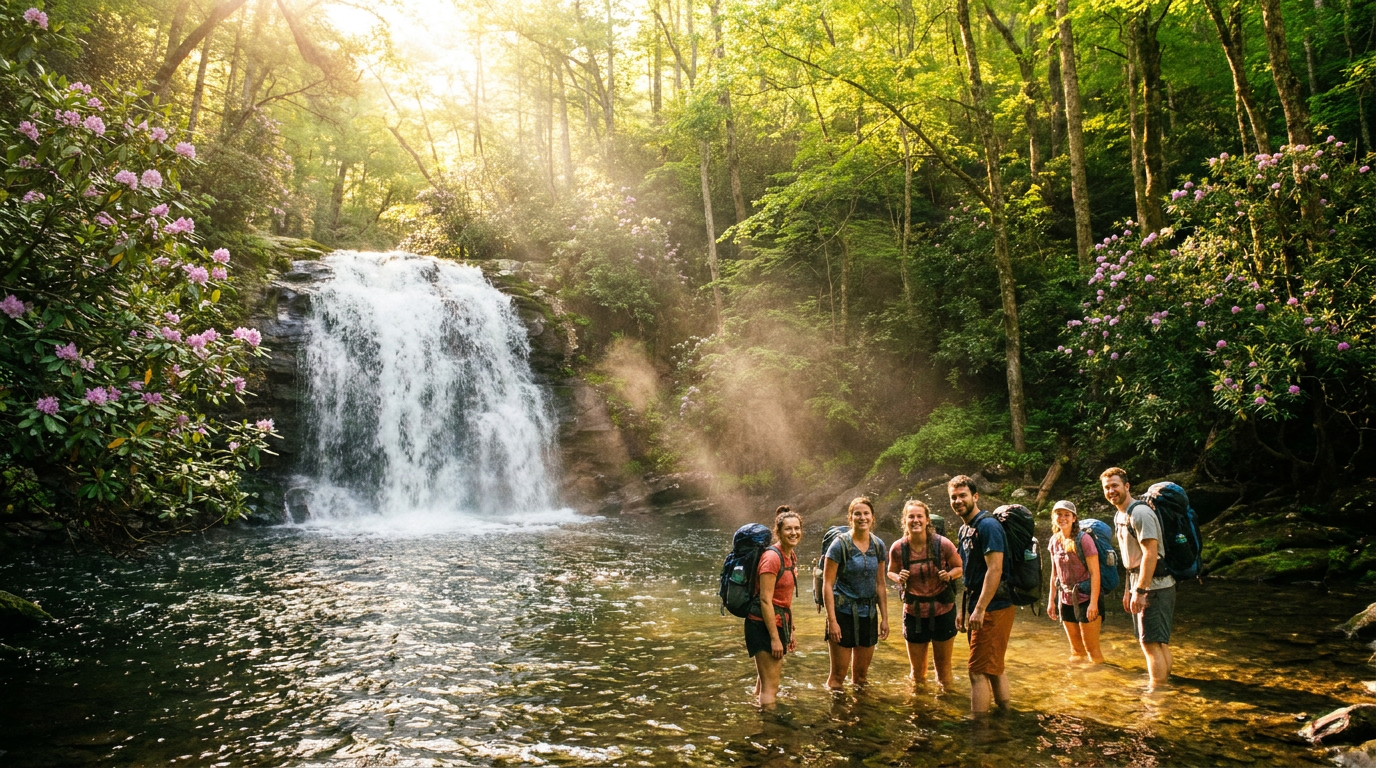
Four hikers stand jammed against a rock cliff to let a family with two leashed spaniels pass. Nobody says anything. The water rushing through the gorge below drowns out the jingling dog collars. The sharp smell of crushed wet pine returns, overtaking the residual bug spray.
2019 me would have resented these congested trailheads. I assumed any path with an overflowing recycling bin was ruined by its own popularity. Somewhere around the second mile, watching a tourist lower his phone to stare quietly at a cascade, my perspective shifted. The mountain itself remains indifferent to the crowds. The cold wind exists on its own terms.
You can secure reliable outdoor gear for your trip through Rockon Recreation Rentals. We cut our teeth handling logistics as a VisitFlorida Travel Partner in 2018 before expanding our trusted regional network to the Blue Ridge Mountains. Wet rock requires the same grip as a slick boat deck. My hands smelled like damp bark for the drive back to town.
This article was researched and written with AI assistance and editorially reviewed by Greg Faucher. Greg writes for Rockon Recreation Rentals. Occasionally, a place earns every word of hype. He'll tell you when it does.
Explore experiences near Asheville
The Physical Toll Of The Ascent
The air pulls thin and tastes like old dirt. You pitch your weight forward against the sudden incline. The granite underneath your boots feels slick with trapped morning dew, forcing a heavy, deliberate rhythm to your steps. According to historical geology data from the University of North Carolina at Asheville, the Blue Ridge escarpment drops hard right here, creating steep gradient changes. Your lungs translate that academic data into a slow ache.
The Solitude Illusion
People enter the woods expecting a silent wilderness. According to the National Park Service, the surrounding national parks see millions of visitors every season. You feel that broad statistic in the physical lack of elbow room and the rhythmic scraping of walking poles directly behind you. The energy shifts when you have to queue for a nature photo.
Look past the official trail infrastructure. The markers themselves are occasionally adorned with strange debris left by previous crowds. I noticed a fluorescent green dog leash tied tight around a wooden post pointing toward a dead-end ravine. It served no obvious purpose and led nowhere. A guy with bright red hiking sticks marched past it without looking. This is the truth of popular outdoor paths. They are shared, messy corridors.
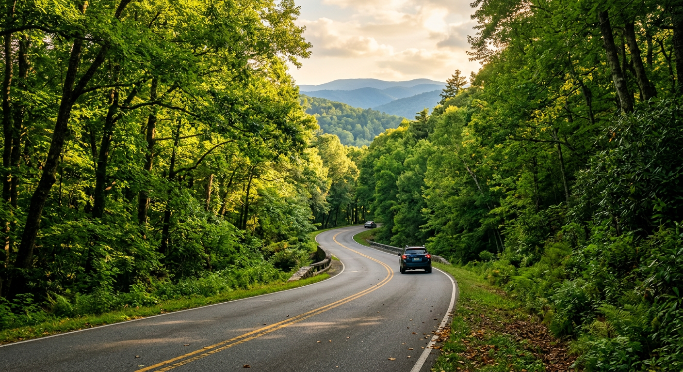
The US-276 Corridor And Parking Hacks
The 2026 Trail Conservancy reports note a sharp uptick in summer trail erosion along the popular US-276 corridor in Pisgah National Forest. That erosion means exposed roots that act like tripwires. Navigating this area requires acknowledging the logistical reality of the geography.
Un-Googleable Trail Logistics
Most visitors typing waterfall hikes asheville nc into their phones default to Looking Glass Falls. The algorithm sends them to a pull-off that becomes a traffic jam by 10:00 AM. I cannot prove this, but the steepest part of any hike always begins with the stress of parking a rental car on a mountain shoulder.
If you park half off the asphalt near the Moore Cove trailhead on a July weekend, you risk losing a side mirror. The logging trucks rumble past, maintaining their speed regardless of pedestrian traffic. The trick locals use isn't a secret map. It is a timing strategy. The un-Googleable truth is that the secondary Pisgah lots clear out precisely at 5:15 PM when the light dips behind the adjacent ridge. The morning crowds retreat to downtown breweries, leaving the evening woods quiet.
The mud near the base of Catawba Falls possesses a distinct, clay-thick viscosity. It does not wash off easily. It cures onto your boot tread and stays there for days. Trust your gut on this, even if the trail map claims it is a dry route. Pack an extra pair of shoes strictly for the drive back.
The Sensible Pivot To Water You Can Ride
You hear the transition before you see it. The hollow scrape of a heavy plastic hull dragging over wet river rocks echoes off the bank. It is the audio signature of someone who has abandoned the hiking path for the current.
Completing steep waterfall hikes asheville nc delivers a solid sense of accomplishment. But you endure thick vegetation, mountain gnats, and vertical climbs just to stand shoulder-to-shoulder with strangers, watching cold water flow away from you. The visual reward is walled off from physical relief.
The trail forums will tell you to spend four days bagging peaks. Around hour three of that first humid afternoon, my priorities shifted rapidly. Staring at an untouchable cascade, I realized I did not want to look at the water anymore. I wanted to sit in it.
Swapping Hiking Boots for River Shoes
The damp air rolling off the river cools the sweat drying on your forehead. Records from the National Weather Service put the French Broad River's average summer water temperature around 68 degrees. On paper, that sounds chilly. Against the back of your sun-baked legs, that temperature hits like a systemic reset to your nerves. The live USGS gauge data puts the current flow at just above a crawl. Knowing to check that decimal point is a habit you develop after hitting bottom on bone-dry rivers.
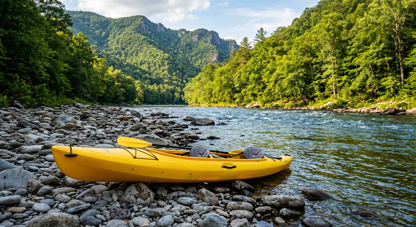
Booking a float or kayak rental through Rockon Recreation Rentals eliminates the logistical friction. You grab a boat from partners like Asheville Outdoor Adventures and Tubing, shove off the muddy bank, and let gravity do the work you were just performing with your hamstrings. The seven-mile float section takes a few hours. Somewhere around mile two, the tension leaves your shoulders and transfers into the slow rotation of the current.
The river tunnel smells of rich limestone and sweet honeysuckle. A cicada buzzes a high, metallic drone overhead. The canvas seat fabric presses rough and damp against your spine. You let the paddle rest flat across your lap and drift.
The Math of Following Gravity
I should mention that tubing the broader sections of the river exposes you to direct afternoon sun. The water reflects the glare upward, baking you from both directions if you forget a hat. The trade-off is worth the mild roasting.
You trade the vertical punishment of the backcountry for a wide, flat glide.
A yellow kayak passes our group on the left. The paddler is not wearing a shirt. He steers around a wide flat boulder and continues downstream, indifferent to the trail traffic above.
The water carries you past the same deep forests you were sweating through yesterday. You dangle a hand over the plastic rim of the boat. The cold current pulls at your fingers.
Explore water adventures near Asheville
Decoding Waterfall Hikes Asheville NC For Skeptics
2021 me thought a twenty-minute paved walk was a legitimate hike. 2026 me knows that is just an outdoor hallway with better scenery.
Following The Water Instead Of The Signs
You push past a tight cluster of rhododendrons, and the ground goes soft under your boots. A thick layer of decomposed bark absorbs your footsteps. The noise of the main tourist trail fades into a dull hum behind you. You stop trying to read faded blazes on the trees and simply walk toward the rushing baseline of the creek below.
According to Travel + Leisure, looking for off-map paths requires balancing adventure with solid navigation respect. The quiet routes for waterfall hikes asheville nc usually start behind places that look like county maintenance sheds. Research is my love language; reality is my ex. I go where the signage is bad and the coffee is good, but I admit that stepping past a chain-link fence and a rusting dumpster feels sketchy when you want pristine nature. The initial fifty yards smell like old motor oil and wet cardboard before the pine scent takes over.
What To Pack For The Rough Routes
Leave the heavy photography gear locked in the trunk. Why carry an extra four pounds of glass and metal just to worry about dropping it in a creek? Local trail blogs insist on packing bulky water filtration systems for a two-hour loop, adding unnecessary bulk to your shoulders. When you swap that tactical backpack for a simple pair of dry merino wool socks, the physical relief is immediate.
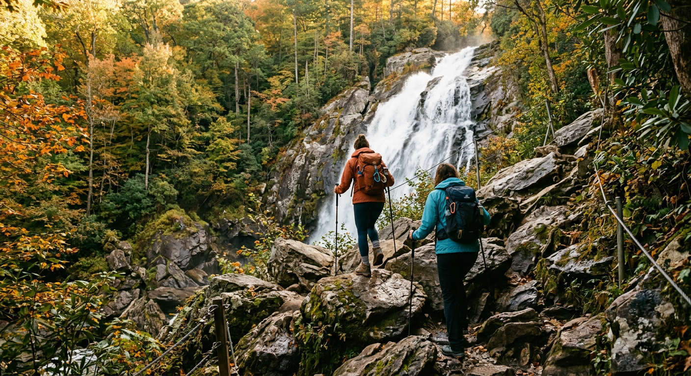
I expected this unmarked logging road to dump us into a muddy dead end. I figured we would turn around after roughly twenty minutes, defeated by washed-out switchbacks and fallen trees. The woods opened up instead, revealing an unnamed fifty-foot drop of water spilling over black rock. The mist felt ice-cold against my hot face, the basin echoed with crashing water, and the air tasted like crushed hemlock needles. Beige is a sin, and finding that spot empty delivered pure color.
We target these quiet friction points when reviewing gear usability for Rockon Recreation Rentals. The water temperature in these shaded gorges hovers around 54 degrees year-round. It is just cold enough to numb your toes right away, providing the kind of mild shock that makes you remember you are awake. You sit down on a sun-warmed boulder, pull an apple from your jacket pocket, and take a bite. The fruit tastes sweeter out here, cut with the slight mineral tang of the mountain air.
Escaping The Asheville Regional Airport Bubble
The automatic doors at the terminal slide open and hit you with a wall of highway noise and damp heat. You step onto the curb expecting immediate wilderness, but Interstate 26 hums fifty yards away. The airport sits at an elevation of 2,165 feet. That number feels like a technicality when you are staring at a line of rental cars idling in the thick summer humidity.
The first thirty minutes of driving away from the runway mostly feature suburban strip malls and unpredictable brake lights. According to analysis from The New York Times, regional flight hubs naturally create these dense commercial corridors. It takes a solid twenty miles of steering through that congestion before you finally outrun the sprawl and the real geography begins to dominate the windshield.
The 2026 FCC cellular coverage map displays reassuring green patches all over the county. Do not trust those green patches. Google Maps struggles with the topography near Brevard. A downloaded topographical map via Avenza will save you from driving up a private, gravel logging road. Once you turn off the main asphalt searching for the real waterfall hikes asheville nc holds, the signal bars drop to zero. Within ten minutes, your phone transforms from a navigation tool into a heavy glass flashlight.
If you eventually head back east down the mountain, swapping the secluded trails for urban exploring like a 1.5 Hour Historic Uptown Neighborhood Tour, or heading further out for a Sunrise Paddle in the Zeke's Island Reserve on the coast, underscores the sheer diversity of North Carolina's geography.
The Shift To Deep Silence
I assumed the transition from downtown’s loud brewery traffic to actual backcountry isolation would require a three-hour drive. I was wrong. The separation is surprisingly thin, resting just past the town limits where the tree canopy closes over the two-lane asphalt. I felt my grip on the steering wheel loosen the moment the FM radio cut to white static.
You walk down a short, unmarked dirt bank and the temperature drops ten degrees in a dozen steps. The air smells sharp with decaying moss, tasting metallic at the back of your throat. The creek water numbs your shins. It pushes against your skin with a heavy, steady pressure while cicadas hum in the upper branches. It feels like finding a secret room in a house you thought you knew.
The water moves over smooth grey stones in the riverbed. Small silver fish hold their position against the current near a submerged log. A wide yellow leaf drifts down through the surface and catches on a shallow sandbar.
Standing waist-deep in the French Broad watershed with the right rental equipment makes the logistical friction of getting to these trails dissolve. You listen to the water cutting through the rocky gorge and realize the airport feels like it belongs to another state.
Related Experiences
Looking to swap the steep routes of waterfall hikes asheville nc for an adventure on the river? Check out this highly-rated local adventure experience from Rockon Recreation Rentals: