1 The Bizarre Geometry Problem of the Canals
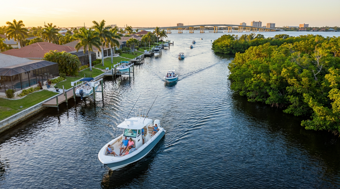
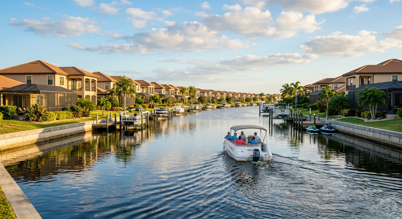
The breeze during a morning of boating in cape coral florida carries a distinct mix of brackish marsh muck, curing fiberglass, and marine fuel. Marketing brochures from Visit Florida love to call this place the Venice of America. They lie. The reality means navigating a maze of identical concrete seawalls. Every intersection mirrors the last. Your spatial memory becomes practically useless. You make a left at a beige house with a pool cage. The next dozen houses feature the exact same beige paint.
A faded pink plastic flamingo stares dead-eyed from a corner dock near the eastern edge of the Bimini Basin. Someone zip-tied it to a piling back in January 2026.
Overly Confident Digital Maps
The sharp ping of a shallow-water alarm cuts through the hum of the outboard. Mobile maps lag in these residential corridors. That delay gives you just enough time to idle past your turn and enter a dead-end lateral canal. Successfully navigating this grid requires reading the water, not just a screen.
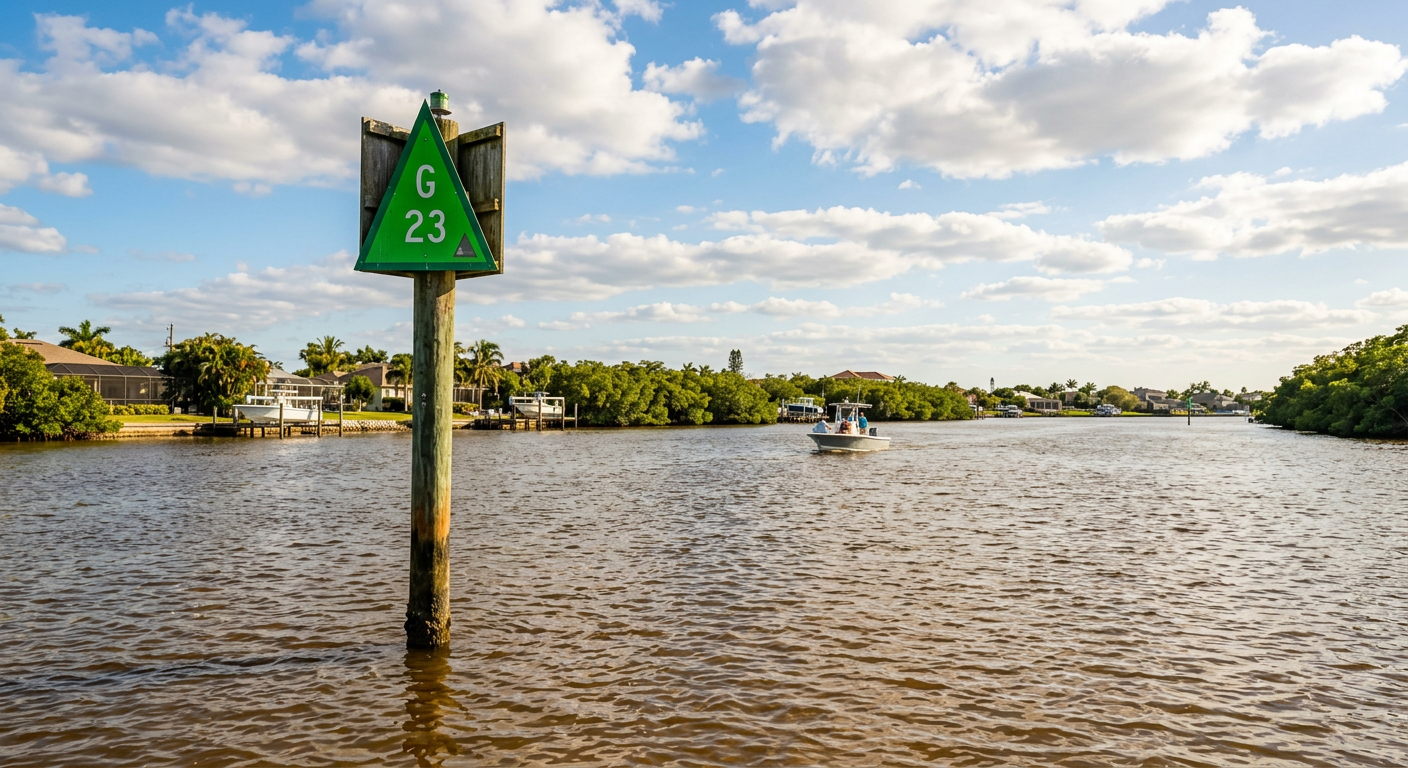
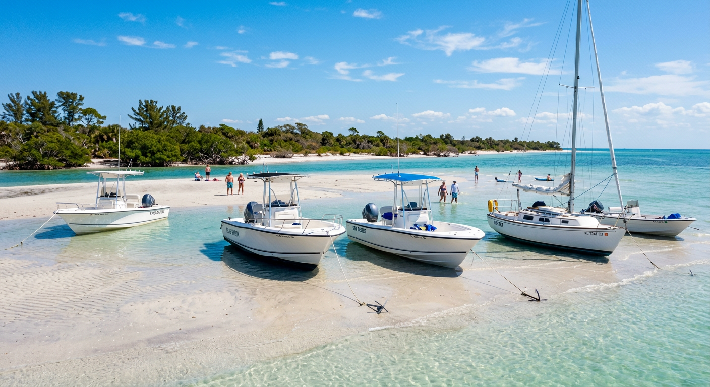
This canal system contains about four hundred miles of navigable water. Heavy seawalls border everything. The speed limit stays at a strict idle. Standard wooden markers point toward the river, but they blend into the background of residential docks.
Hardware Over Software
Running this grid blind means endless backtracking. Research is my love language; reality is my ex. According to data from the U.S. Coast Guard, spatial disorientation remains a top cause for local tow assists in the region. You will stare at a phone guessing your route, missing the actual physical channel completely. Book through Rockon Recreation Rentals to get reliable marine hardware. If you haven't reserved your vessel yet, the 21ft Mako Boat Rental Cape Coral features customized chartplotters mapped to these blind corners.
Trust the transponder on the dash. That weak cell signal bouncing off a few thousand stucco mansions will only lie to you.
Explore boating experiences near Cape Coral
2 Shifting Sandbars Humiliate the Confident
The hollow scrape of outboard fiberglass hitting submerged sand vibrates right up into your knees. That abrupt thud kills all conversation on board. Escaping a soft grounding takes exactly 14 seconds of frantic engine tilting and a $342 lesson in humility. According to the Florida Department of Environmental Protection, Caloosahatchee River shoals move on a whim. The tides push loose sediment right into designated paths. You sit dead in the water, questioning your basic competence. What makes boating in cape coral florida such a mental exercise?
The answer usually floats right in front of you on a barnacle-crusted wooden pole.
The Hubris of Paper Charts
Back in 2018, I assumed a paper map was enough out here. I used to think the river was wide open and forgiving. I would toss a chart on the console and aim for the Gulf. By 2026, my approach looks different. Experience says you need a working depth sounder to clear the Sanibel Causeway without ruining a propeller. The wind cuts the surface chop. It easily hides the flat ripples of a shallow shelf.
I cannot prove the green channel markers shift positions at night. Trust your gut on this, even if the manual disagrees. Half of them feel out of place by morning. The river current drags the sandy bottom around the pilings while you sleep. Charts treat these waters as static highways. They are not. Even NOAA coastal updates prioritize major shipping lanes over these ghost channels. You end up reading water color instead of a screen.
Reading the Brown Water
The tide dropped. The water pulled back to expose a massive sandbar twisting right through the safe zone. The chart wasn't wrong. The earth had just moved since the latest survey. The digital lines lost their meaning. If your Florida itinerary ultimately takes you to the opposite coast, a Fort Lauderdale Full-Day Sailing Charter offers deeper, more forgiving marine paths, but navigating the shallow Gulf coast demands grit.
The water near the outer marker glows shallow and brown. The sandbar sits a foot below the surface. Two white pelicans stand on the northern edge. The passage narrows to a few boat lengths. The wind blows from the west.
Does this sound like overcomplicating things? Probably. But baseline caution keeps you off the towboat ledger. Book through Rockon Recreation Rentals to get a vessel with updated local waypoints. You want hardware that knows the river's latest tricks. Confidence out here just precedes a long towline.
3 The Gulf Access Myth and Idle Speed Zones
The Florida humidity does not waver during a summer morning transit out of the sprawl. You feel the thick air settle onto your shoulders as a physical weight. The boat creeps past dock after identical dock. Brochures claim you will skip across the Gulf in minutes. False. Reality forces a prolonged, monotonous crawl through no-wake zones for a few miles. If it's on a postcard, it's a trap.
Most visitors expect to point the bow west and fly. Not here. The journey down the Caloosahatchee requires real patience. Checking the local forecast via the NOAA National Weather Service helps prepare you for these long, exposed stretches. You will spend about an hour doing nothing but watching your stern wake. I noticed a cracked blue bucket sitting upside down near a residential lift. The transit from an inland rental to the bridge eats up half your morning.
Manatee protection zones stretch across the main channels. Square white signs with orange circles dictate the speed. According to data from the Florida Fish and Wildlife Conservation Commission, patrols actively monitor these invisible borders. They wait near zone transitions. Accelerate a foot too early, and you get a ticket. Boating in cape coral florida means respecting this slow crawl.
Reading the Surface for Sea Cows
I used to think avoiding manatees meant spotting large gray shapes. Good luck doing that in tea-colored tannic water. The trick is reading surface tension. A manatee does not splash like a mullet. You look for a flat, silent circular slick on the water. Two small nostrils pop up like river stones, then vanish.
By the time you notice those nostrils, the bulk of the animal rests directly under your bow.
These idle corridors demand visual sweeps through heavy glare. The long stretches test your focus. While some crews prefer the non-stop open-throttle action of reserving a Miami Beach the BIG Sundancer Boat Rental, dodging local manatees forces you into the waterway's slow rhythm. Deep into the 2026 season, heat waves blur the horizon. Renting through Rockon Recreation Rentals secures a large bimini top for shade. This mandatory pacing forces you to stop fighting the clock.
Explore top-rated boat rentals near Cape Coral
4 The Cayo Costa Sandbar Trap
The metallic grit of stale sea salt on your lips defines the real Cayo Costa experience. You misjudge the tide schedule by a few minutes. The Gulf water recedes. It drops your hull onto hardpacked sand. Now you sit there roasting, waiting for the ocean to come back. People assume the outer islands provide endless deep water. The state park manual calls this a pristine getaway. It functions more like a mousetrap for day-trippers.
Most captains see a cluster of boats near the drop-off and assume it signifies a deep trough. Half of those boats are actually stuck in the mud.
Following the Pack Leads to the Sand
2022 me blamed this grounding ritual on bad driving. I judged the people standing waist-deep next to trapped rentals. 2026 me knows better. I finally realized the crowds aren't bad drivers; the map is just a suggestion. According to the U.S. Geological Survey bathymetry data, bottom contours change with every passing storm. The safe channel you mapped last week simply erased itself. While Cayo Costa is a renowned state park, rapid shoaling happens across the barrier islands managed by the National Park Service further down the coast. The realities of boating in cape coral florida demand adaptation.
Practical Draft Management
Monitor the falling tide closely before dropping anchor. Water dumps out fast through Boca Grande Pass. Book a vessel through Rockon Recreation Rentals for reliable access to digital tidal data. You just have to remember to check the screen.
State park staff maintain a small dock on the bayside. Restrooms and cold water showers sit near the primitive campsites.
A seagull with a missing left toe stood on a wooden piling nearest the bathhouse path. It faced south.
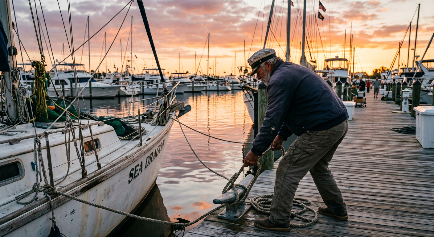
5 Navigating the Morning Marina Chaos
The sticky residue of old salt spray coats the aluminum dock rails before dawn. By eight in the morning, the local launch ramp operates on hostile, silent choreography. Residents back trailers down the incline without touching their brakes. Vacationers stand in stiff performance shirts, reading manuals for vessels they just rented. Compared to piling onto a Miami Party Boat on the east coast, mornings here require technical understanding.
A guy in a faded visor drops a half-eaten maple donut on the concrete. The gulls ignore it.
Boats launch at a steady pace. The concrete ramp angles into dark water. Wood pilings line the side of the launch. White hulls float near the edge of the channel.
The Social Hierarchy of the Docks
You learn the rhythm by staying out of the way. The Florida Fish and Wildlife Conservation Commission reports that Lee County sees the highest vessel traffic in the region. Booking your day through Rockon Recreation Rentals skips the trailer-backing ritual entirely. You just walk down the slip, untie the lines, and leave.
In 2019, I viewed the canal speed limits as pure bureaucracy. Creeping past miles of backyard pools felt like a subjective punishment. My perspective finally changed. The forced slowdown acts as a buffer. It drains the aggressive marina energy out of you. You have to sit and steer until the morning stress fades. Anyone renting a vessel needs to learn this lesson early.
The Gulf pushes water back in regardless of your timeline. You either clear the sandbar on the way out, or you sink into the mud. Then you just wait for the moon to fix your mistake.
6 The Math of the Chiquita Lock Bottleneck
The radiant heat coming off the concrete barriers of the southern channel hits your face like an open oven door. Most guides skip over this physical choke point. You leave the freshwater canals to enter the salty transition zone near Tarpon Point. Getting through requires waiting your turn in a floating parking lot of anxious captains. Getting back in during the afternoon rush introduces a new level of endurance.
According to local municipal water management reports, this single gate regulates the southern grid's exposure to the shifting tides. In practice, it regulates your patience. Lines form. Engines idle. People stare at their phone screens.
Timing the Afternoon Return
The trick involves arriving before the late afternoon thunderstorm window opens. You tie off to the wet, barnacle-covered ropes along the wall. The water level slowly equalizes. The massive gates swing outward. Then it becomes a disjointed sprint to the main river channel.
I cannot prove that the lock behaves differently on a falling tide, but the currents sweeping out of the basin feel heavier. Renting through Rockon Recreation Rentals means you secure a hull capable of fighting that outbound wash without faltering. The water dictates the schedule. You just have to sit there and wait.
7 The Illusion of Sanibel Anchorage
The gritty sting of windblown sand hitting your forearms signals the crossing into San Carlos Bay. Anchoring near the lighthouse looks brilliant on paper. The reality features relentless crosscurrents fighting the Gulf tide head-on. According to the Lee County Port Authority marine advisories, this specific wedge of water processes thousands of gallons a second during tide shifts.
You drop a standard anchor. It drags across the bottom. You pull it back up wrapped in stubborn sea grass.
Finding the Secondary Holding Ground
Beige is a sin, and standard travel advice rarely saves you here. The official guides tell you to head straight for the lighthouse beach zone. Do not do this. The anchorages sitting slightly further north offer better holding ground and fewer swamped bows from passing wakes. The current operates on its own set of rules on this edge of the island.
I left a cheap pair of polarized sunglasses on the console here once in 2021. A rogue wave from an incoming trawler swept them into the inlet immediately. The Gulf demands a toll for casual mistakes.
Essential Gear for Navigating the Gulf
If you want to tackle the expansive canals and safely navigate out to the open waters, starting with the right vessel changes everything. Explore the premier outing sourced exclusively for the Cape Coral region: